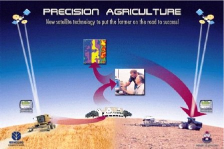
THE PRACTICE OF PRECISION FARMING
Stes de Necker
Precision farming integrates a number of technologies in order to optimize the benefits of mechanization, which is so essential for effective food production. By using satellite data to determine soil conditions and plant development, these technologies can lower the production cost by fine-tuning seeding, fertilizer, chemical and water use, and potentially increasing yield production and lowering costs — all benefiting the farmer. In turn, precision agriculture may have significant impacts far beyond the individual farm. Pollution is a common problem stemming from agricultural practices. Excess agricultural chemicals must go somewhere, and somewhere frequently means the common environment. Agricultural chemicals which may play a vital role in agricultural production, may well be considered pollutants once it has reached the common environment.
At its heart, the application of precision agriculture requires two spatial requirements:
(1) Concurrent knowledge of where the farm equipment is at any given time, and
(2) The value of one or more variables as a positioning function within a given field.
These variables requirements two sets of information; the “where” and the “what.”
Spatial precision needed for “where” varies from a few meters to a few centimetres, that can be satisfied by GPS, data processing systems. In fact, using real-time GPS, it is possible to guide farming equipment to stay along a track of hundreds of meters long with only centimeter-scale deviations.
The second requirement, the “what,” is where remote sensing comes into the picture.
The electronics revolution of the last decades has spawned two technologies that will impact agriculture in future. These technologies are Geographic Information Systems (GIS) and Global Positioning System (GPS). Along with GIS and GPS there have appeared a wide range of sensors, monitors and controllers for agricultural equipment such as shaft monitors, pressure transducers and servo motors. Together they will enable farmers to use electronic guidance aids to direct equipment movements more accurately, provide precise positioning for all equipment actions and chemical applications and analyze all of that data in association with other sources of data (agronomic, climatic, etc). This will add up to a new and powerful management tool for the progressive farm manager.
Just as industrial manufacturing has changed radically over the last century, farming also need to change. The classic example of the farming being a way of life is long outdated. Farming has become a business which must be conducted on sound business practices. Costs, technology and economies of scale have forced most commercial farms around the world to change. And precision farming is beginning to play an ever increasing role in the quest for survival in the agricultural sector.
Precision farming should not be thought of as only yield mapping and variable rate fertilizer application and evaluated on only one or the other. Precision farming technologies will affect the entire production function (and by extension, the management function) of the farm. It is not only about an abstract measurement or characterization. It is about specific values at exact locations, assisting the farmer.
Precision farming will result in an explosion in the amount of records available for farm management. Electronic sensors can collect a lot of data in a short period of time. Lots of computer storage space is needed to store all the data as well as the map graphics resulting from the data. There are currently a number of electronic controllers which will record data electronically.
It is necessary that fertilizer rates actually put down by the application equipment, is according to the requirements of the actual needs recorded by a prescription map. A lot of new data is generated every year (yields, weeds, etc). Farmers will want to keep track of the yearly data to study trends in fertility, yields, salinity and numerous other parameters. This means a large database is needed with the capability to archive, and retrieve data for future analyses.
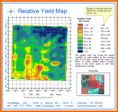
Yield monitoring.
Instantaneous yield monitors are currently available from several manufacturers for all recent models of combines. It provide a crop yield by time or distance (e.g. every second or every few metres). It also track other data such as distance and tonnage per load, number of loads and fields. Yield mapping GPS receivers coupled with yield monitors provide spatial coordinates for the yield monitor data. This can be made into yield maps of each field. Variable rate fertilizer variable rate controllers are available for granular, liquid and gaseous fertilizer materials. Variable rates can either be manually controlled by the driver or automatically controlled by an on board computer with an electronic prescription map.
Weed mapping
 |
| Yield mapping during harvesting |
Weed mapping
A farmer can map weeds while combining, seeding, spraying or field scouting by using a keypad or buttons hooked up to a GPS receiver and data-logger. These occurrences can then be mapped out on a computer and compared to yield maps, fertilizer maps and spray maps. Variable spraying by knowing weed locations from weed mapping spot control can be implemented. Controllers are available to electronically turn booms on and off, and alter the amount (and blend) of herbicide applied.
Topography and boundaries
Using high precision GPS a very accurate topographic map can be made of any field. This is useful when interpreting yield maps and weed maps as well as planning for grassed waterways and field divisions. Field boundaries, roads, yards, tree stands and wetlands can all be accurately mapped to aid in farm planning.
Salinity mapping GPS can be coupled to a salinity meter sled which is towed behind an ATV (or pickup) across fields affected by salinity. Salinity mapping is valuable in interpreting yield maps and weed maps as well as tracking the change in salinity over time.
 |
| Topography mapping of a field |
Salinity mapping GPS can be coupled to a salinity meter sled which is towed behind an ATV (or pickup) across fields affected by salinity. Salinity mapping is valuable in interpreting yield maps and weed maps as well as tracking the change in salinity over time.
Guidance systems
Several manufacturers are currently producing guidance systems using high precision DGPS that can accurately position a moving vehicle within a foot or less. These guidance systems may replace conventional equipment markers for spraying or seeding and may be a valuable field scouting tool.
 |
| The "layerd" approach. Looking at a three dimensional analysis of a field |
Several benefits are achieved from an automated method of capturing, storing and analyzing physical field records. Detailed analyses of the farm production management activities and results can be carried out. Farmers can look at the performance of new varieties by site specific area, measure the effect of different seeding dates or depths and show to their banker the actual yields obtained and the associated risk levels. It is imperative that trends and evaluations are also measured over longer time spans. Cropping strategies to control salinity for instance, may take several years to evaluate while herbicide control of an annual weed should only take one season.
Precision farming should be approached in stages, in order to ease into a more complex level of management. Precision farming does not "happen" as soon as one purchases a GPS unit or yield monitor. It occurs over time as a farmer adopts a new level of management intensity on the farm.
Implicit in this is an increased level of knowledge of the precision farming technologies such as GPS and GIS. What is perhaps more important for the success of precision farming, at least initially, is the increased knowledge that a farmer needs of his natural resources in the field. This includes a better understanding of soil types, hydrology, microclimates and aerial photography. A farmer should identify the variance of factors within the fields that effect crop yield before a yield map is acquired. A yield map should serve as verification data to quantify the consequences of the variation that exists in a field. Management strategies and prescription map development will likely rely on sources other than yield maps. The one important key source of data a farmer should not start precision farming without an aerial photograph.
 |
| Sattelite image of a production field |
Precision farming makes farm planning both easier and more complex. There is much more map data to utilize in determining long term cropping plans, erosion controls, salinity controls and assessment of tillage systems. But as the amount of data grows, more work is needed to interpret the data and this increases the risk of misinterpretation. Farmers implementing precision farming will likely work closer with several professionals in the agricultural, electronics and agricultural equipment manufacturing sectors.
Precision farming is ideally suited for improved economic analyses. The variability of crop yield in a field allows for the accurate assessment of risk. For example, a farmer could verify that for 70 % of the time, 75 % of the maize grown in field "A" will yield X ton per hectare. By knowing the cost of inputs, farmers can also calculate return over cash costs for each square meter of the field. Certain parts of the field which always produce below the break even line can then be isolated for the development of a site-specific management plan.
Precision farming allows the precise tracking and tuning of production.
Anyone interested in obtaining more information on precision farming is welcome to contact Stes de Necker at: stesdenecker@telkomsa.net
Fax to Email: 0866125254
 |
| Knowing your exact profit or loss per hectare |
Precision farming allows the precise tracking and tuning of production.
Anyone interested in obtaining more information on precision farming is welcome to contact Stes de Necker at: stesdenecker@telkomsa.net
Fax to Email: 0866125254
Sources:
Tom Goddard, Conservation and Development Branch, Alberta
Barnes, E.M., and Baker, M.G. (2000). Multispectral data for mapping soil texture: possibilities and limitations. Am. Soc. Agricultural Engineers, 16, 731-41.
Bryson, R. J. 2000. Remote sensing in agriculture. 26-28 June 2000. Royal Agricultural College, Cirencester.
Bryson, R. J. 2000. Remote sensing in agriculture. 26-28 June 2000. Royal Agricultural College, Cirencester.
Find some more interesting
articles on my blog.
Just click http://stesdeneckers.blogspot.com
No comments:
Post a Comment